01
Difficulty
Easy to Moderate
 RHCPRunning & Hiking Club Pakistan
Trail Guide · Thandiani Forest Range
Batadana — Sattu Bungalow Trail · Abbottabad
Running & Hiking Club Pakistan · Khyber Pakhtunkhwa
* Elevation is for Sattu Bungalow (~2,893 m / 9,500 ft, per RHCP). Road is Abbottabad city to Thandiani (OSRM). Trail distances are approximate (RHCP concept note).
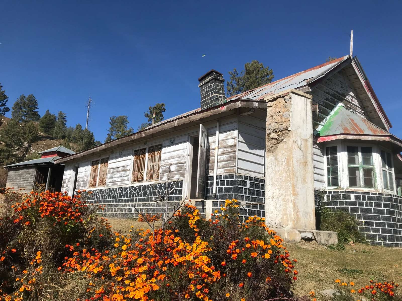
A British-era forest rest house in the Thandiani Forest Range
Schematic, not to scale. Distances from the RHCP concept note (approximate).
Short route: from Batadana village, ~5 km
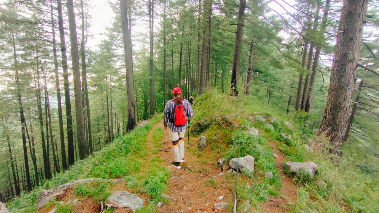
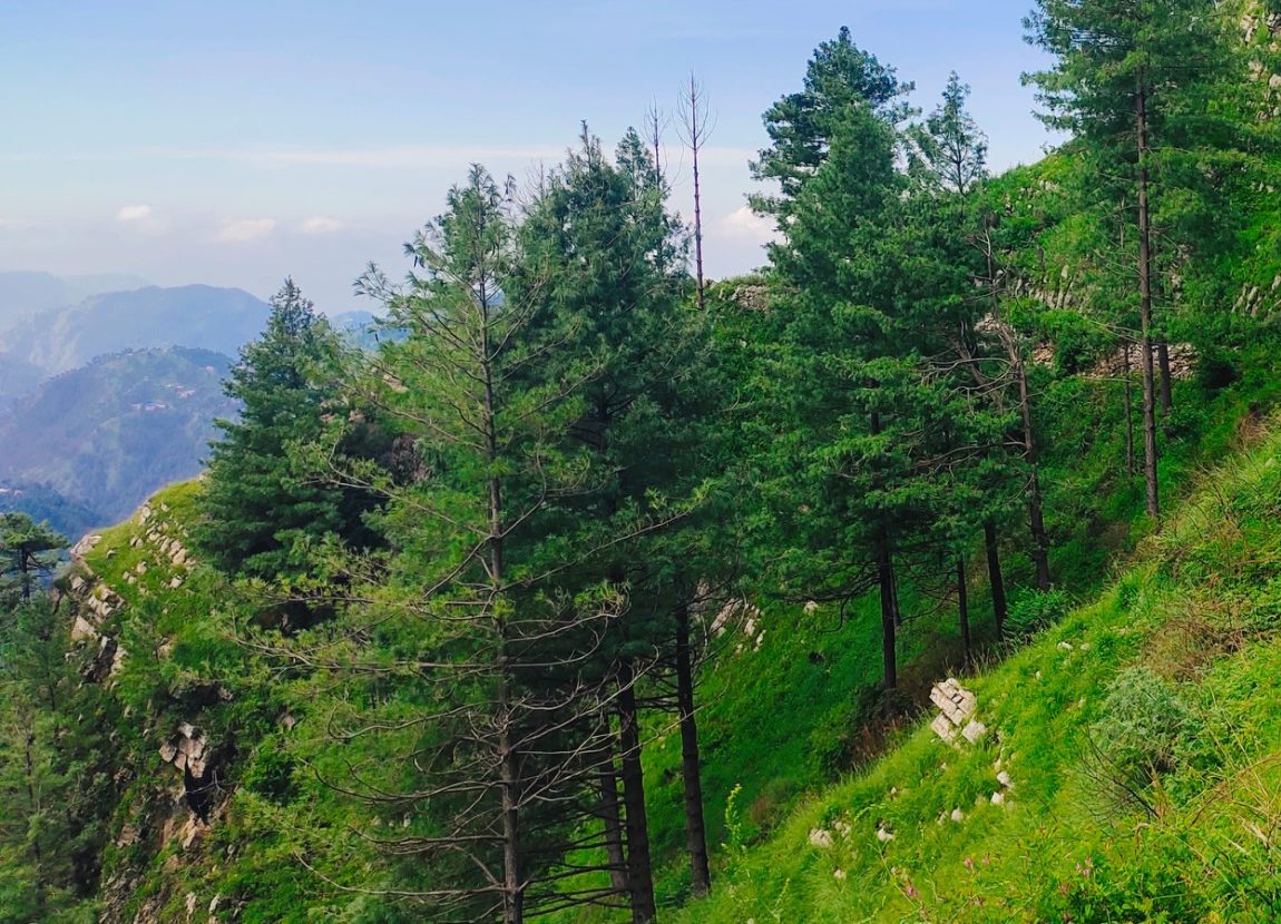
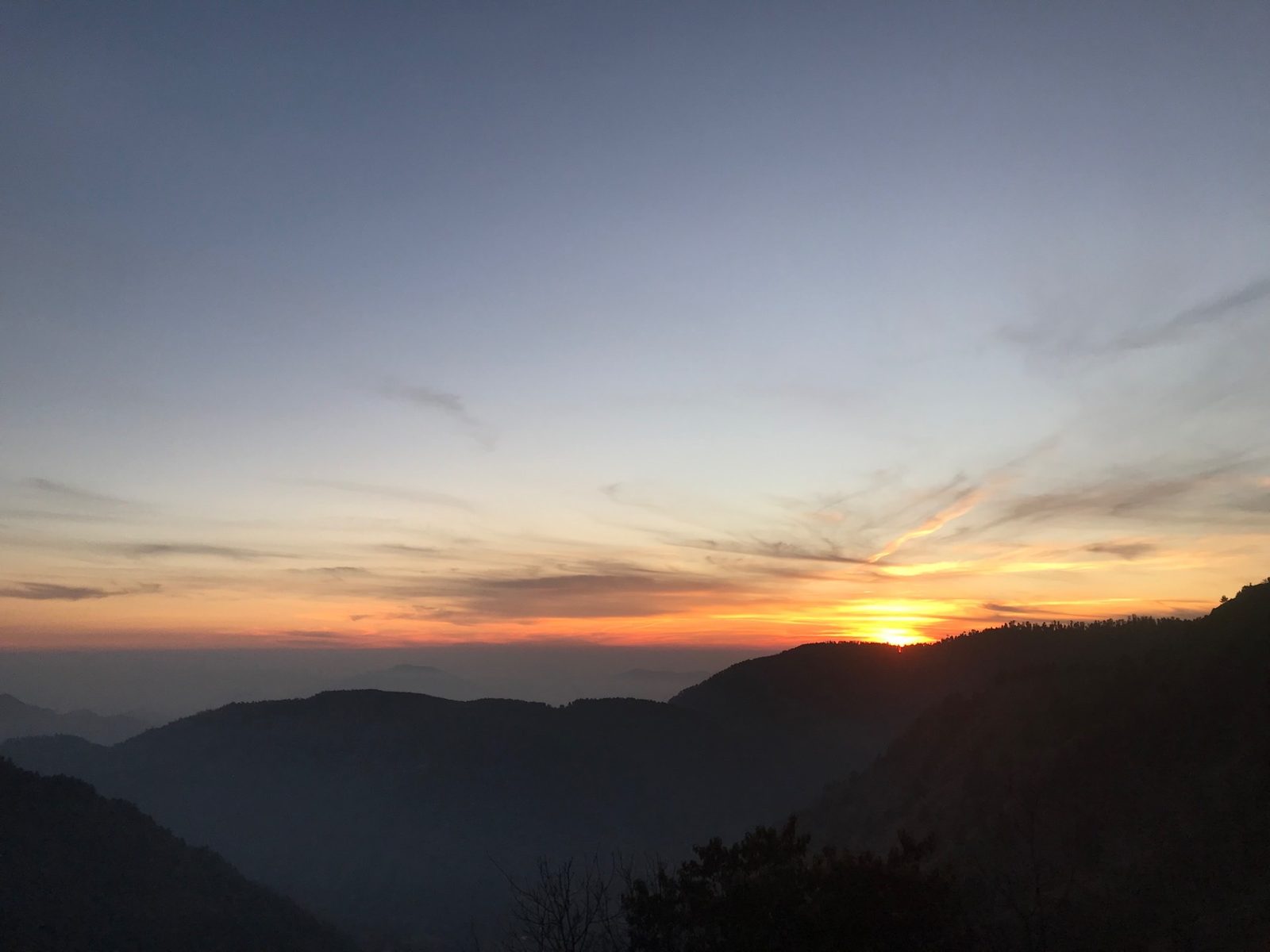
A forest trail from Jhala up to the historic Sattu Bungalow. The first ~5 km to the water tank is relatively easy; the climb starts after it. Viewpoints look out to the Kashmir-side ranges and the Siran Valley.
Carry all litter back, cut down on plastic, don't harm trees or wildlife, and never light unsafe fires in the forest.
Natural springs are this trail's most valuable asset. Keep them clean and leave no waste near the water.
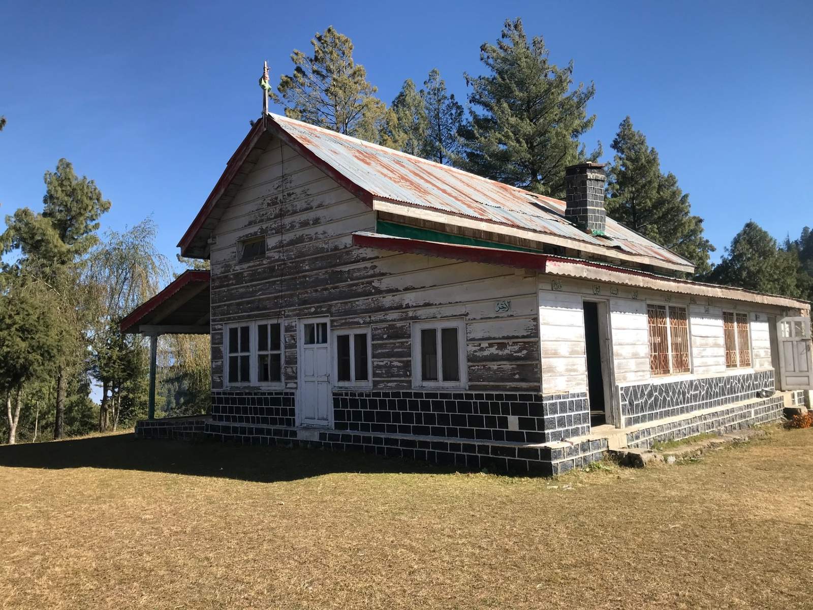
An old Forest Rest House at a high point of the Thandiani Forest Range, said to date from the British era.
Trail distances: RHCP concept note (approx.) · Elevation: Sattu Bungalow, per RHCP
Road: OSRM, Abbottabad city to Thandiani · Trailhead (Jhala) is not on public maps
Full details from the RHCP concept note for sustainable tourism & trail development.
Nestled within the dense Thandiani Forest Range at an elevation of approximately 2,893 meters (9,500 feet) above sea level, Sattu Bungalow is an ancient, picturesque British-era forest rest house built in classic Victorian architecture.
Various theories exist regarding the origin of the name "Sattu." While "Sattu" in common Urdu/Hindi refers to a traditional barley-based drink, the location has no historical connection to it.
According to local tradition and historical accounts, when the bungalow was constructed during the British colonial era (around the 1890s), a high peak or flat ridge was chosen. In the local dialect, such a roof-like high plateau was referred to as Sattu.
Among the series of forest inspection bungalows constructed by the British administration across these mountain ranges, this was built at position number seven — hence named Satwan Bangla (Seventh Bungalow), which gradually evolved into Sattu Bangla over time in the local dialect.
The name is a local corruption of a British officer's name, though the high-ridge theory remains the most historically supported.
Located between Abbottabad and the Galiyat region, this serene retreat offers breathtaking panoramic views of the Pir Panjal range and the snow-capped mountains of Kashmir. It stands as a historic landmark and a favored haven for nature lovers and hikers alike.
The trail guideMultiple scenic routes lead to Sattu Bungalow, passing through dense pine forests and pristine natural landscapes. Detailed guide information for one of the most popular and scenic trekking routes is provided below.
The roughly 9 km natural forest path from Batadana to Sattu Bungalow lies in a beautiful and relatively little-known part of the Abbottabad / Thandiani Forest Range.
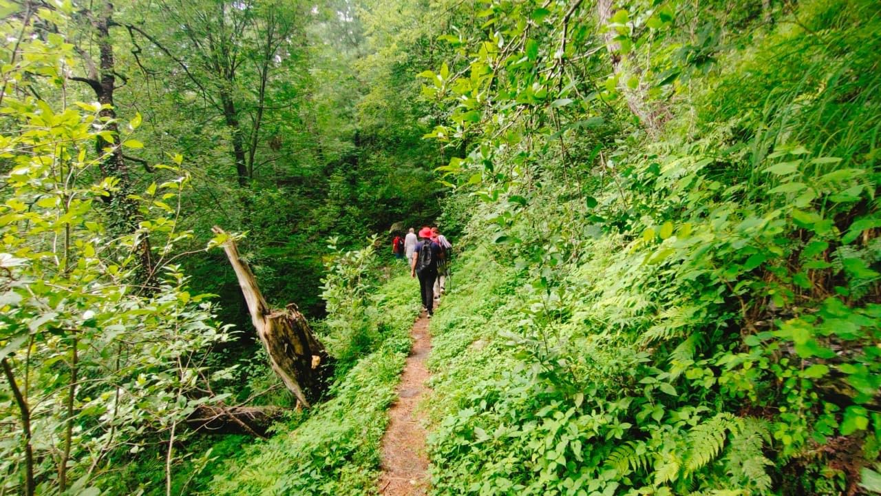
The trail offers dense forest, natural springs, a water tank, natural viewpoints, mountain scenery and access to the historically significant Sattu Bungalow.
Given its existing natural features and suitable terrain, the area has the potential to be developed as a low-impact eco-tourism and hiking destination.
Core aim of the proposalRather than a large construction project, make the existing natural path safe, clear, accessible and visitor-friendly with minimal environmental intervention.
In the initial phase, the trail entrance, signage, trail marking, cleaning, protection of the natural springs and viewpoints, and basic safety information can be provided.
Hazara Division, particularly Abbottabad, Thandiani and the Galiyat, has notable tourism potential thanks to its natural forests, high mountain areas, historic sites and natural scenery.
However, many beautiful natural paths still lack formal trail management, signage and basic visitor facilities. The Batadana — Sattu Bungalow trail is one of them, and with proper planning it can become an organised hiking and eco-tourism route.
The trail starts at Jhala. The concept note proposes an eco-friendly entrance gate here.
Roughly the first 5 km, up to the water tank, is relatively easy and accessible.
After the water tank the climb begins. The upper section has a Forest Hut that could in future serve as a rest point or a controlled camping facility.
The trail ends at the historic Sattu Bungalow. Total distance is about 9 km.
A shorter hiking route of about 5 km also starts from Batadana village.
The trail has at least two natural springs and one water tank.
Difficulty: easy to moderate. Type: forest, nature and hiking trail. First stretch relatively easy; the climb starts after the tank.
Natural viewpoints along the trail look out over Batadana, the mountain ranges towards Kashmir and the mountains of the Siran Valley.
Dense forest, natural springs and natural viewpoints.
According to the concept note, the trail's current condition is:
Leave No TraceAll visitors should carry their litter back, cut down on plastic, not harm trees or wildlife, and never light unsafe fires in the forest.
The trail has the potential to be developed for the following activities:
Batadana village could also be developed as a Local Tourism Support Point.
Despite this beautiful natural path, the challenges are:
ObjectiveDevelop the Batadana — Sattu Bungalow trail as a safe, environment-friendly, organised and community-based eco-tourism hiking destination.
Build an eco-friendly entrance gate at the Jhala trailhead showing: trail name, distance, difficulty level, estimated hiking time, safety instructions, emergency contacts, forest rules and Leave No Trace guidelines.
Install clear signboards at key points: start point, water spring, water tank, viewpoint, Forest Hut, camping area, Sattu Bungalow and Batadana village.
Place distance markers every 1 km or at suitable intervals so hikers know their position and the distance remaining.
Clear bushes where needed (without harming the environment), mark slippery and hazardous sections, and make minor improvements using natural stone or eco-friendly materials.
The natural springs are this trail's key natural asset. To protect them:
Develop the existing natural viewpoints without unnecessary construction — only a safety rail, wooden seating and information boards.
Use the Forest Hut above the water tank as a rest point, emergency shelter or controlled camping support point.
Batadana village can become an important Local Tourism Support Point for the trail. Local people can gradually be offered employment as:
| Institution / stakeholder | Proposed role & responsibility |
|---|---|
| Forest Department | Forest area assessment, trail permission / management, Forest Hut assessment, environmental protection |
| Tourism Department | Tourism promotion, trail branding, tourist information & promotional material |
| Local Administration | Inter-departmental coordination, access & local facilitation, community coordination |
| Environmental Authorities | Environmental assessment, eco-friendly development guidelines, conservation measures |
| Local Community | Guide services, maintenance support, local tourism services |
As an outdoor community organisation, RHCP offers the relevant institutions voluntary and technical cooperation in:
Joint site visit, GPS mapping, risk & water assessment.
Entrance gate, signage, distance markers, trail clearing, spring protection.
Viewpoint development, controlled camping area, local guide training, promotion.
| Task / measure | Priority |
|---|---|
| Joint trail survey & GPS mapping | High priority |
| Entrance gate, directional signage, distance markers | Immediate |
| Trail clearing & natural spring protection | Immediate |
| Safety measures & risk mitigation | Immediate |
| Viewpoint management & waste management system | Priority |
| Controlled camping area & Forest Hut assessment | Phase II |
| Tourism promotion & CBT capacity building | Phase II |
A new, organised hiking route.
Jobs and security through guides, transport and porters.
Organised protection of the natural setting.
Positive outdoor activities.
A new eco-tourism identity for Abbottabad.
Subject: developing the Batadana — Sattu Bungalow trail as a safe, organised and environment-friendly eco-tourism hiking destination.
ٹھنڈیانی فاریسٹ رینج کے گھنے جنگلات میں سطحِ سمندر سے تقریباً 2,893 میٹر (9,500 فٹ) کی بلندی پر واقع ستو بنگلہ برطانوی دور کا ایک قدیم اور دلکش فاریسٹ ریسٹ ہاؤس ہے، جو کلاسیکی وکٹورین طرزِ تعمیر میں بنایا گیا ہے۔
لفظ "ستو" کی وجہ تسمیہ کے بارے میں مختلف نظریات پائے جاتے ہیں۔ اگرچہ عام اردو/ہندی میں "ستو" جَو سے بنے ایک روایتی مشروب کو کہا جاتا ہے، لیکن اس مقام کا اس سے کوئی تاریخی تعلق نہیں۔
مقامی روایات اور تاریخی حوالوں کے مطابق جب برطانوی نوآبادیاتی دور (تقریباً 1890 کی دہائی) میں یہ بنگلہ تعمیر کیا گیا تو اس کے لیے ایک بلند چوٹی یا ہموار پہاڑی دھار کا انتخاب کیا گیا۔ مقامی بولی میں چھت نما ایسی بلند سطحِ مرتفع کو "ستو" کہا جاتا تھا۔
برطانوی انتظامیہ نے ان پہاڑی سلسلوں میں جنگلات کے معائنے کے لیے بنگلوں کا جو سلسلہ تعمیر کیا، ان میں یہ ساتویں نمبر پر بنایا گیا — اسی لیے اسے "ساتواں بنگلہ" کہا گیا، جو وقت کے ساتھ مقامی بولی میں بدل کر "ستو بنگلہ" بن گیا۔
یہ نام کسی برطانوی افسر کے نام کی بگڑی ہوئی مقامی شکل ہے، تاہم تاریخی اعتبار سے بلند پہاڑی دھار والا نظریہ ہی سب سے زیادہ معتبر سمجھا جاتا ہے۔
ایبٹ آباد اور گلیات کے درمیان واقع یہ پُرسکون مقام پیر پنجال کے پہاڑی سلسلے اور کشمیر کے برف پوش پہاڑوں کے دلفریب اور وسیع مناظر پیش کرتا ہے۔ یہ ایک تاریخی نشانی ہونے کے ساتھ ساتھ فطرت سے محبت کرنے والوں اور ہائیکرز کی پسندیدہ پناہ گاہ بھی ہے۔
ٹریل گائیڈستو بنگلہ تک کئی خوبصورت راستے جاتے ہیں، جو چیڑ کے گھنے جنگلات اور اچھوتے قدرتی مناظر سے گزرتے ہیں۔ ان میں سے ایک مقبول ترین اور خوبصورت ترین ٹریکنگ روٹ کی تفصیلی گائیڈ ذیل میں پیش کی گئی ہے۔
بٹہ دانہ سے ستو بنگلہ تک تقریباً 9 کلومیٹر طویل قدرتی جنگلاتی راستہ ایبٹ آباد / ٹھنڈیانی فاریسٹ رینج کے ایک خوبصورت اور نسبتاً کم معروف علاقے میں واقع ہے۔
یہ ٹریل گھنے جنگلات، قدرتی چشموں، پانی کی ٹینکی، قدرتی ویو پوائنٹس، پہاڑی مناظر اور تاریخی اہمیت رکھنے والے ستو بنگلہ تک رسائی فراہم کرتا ہے۔
موجودہ قدرتی خصوصیات اور موزوں جغرافیائی ساخت کی بنیاد پر یہ علاقہ کم ماحولیاتی اثر والی ایکو ٹورازم اور ہائیکنگ منزل کے طور پر ترقی کی صلاحیت رکھتا ہے۔
تجویز کا بنیادی مقصدکسی بڑے تعمیراتی منصوبے کے بجائے موجودہ قدرتی راستے کو کم سے کم ماحولیاتی مداخلت کے ساتھ محفوظ، واضح، قابلِ رسائی اور سیاح دوست بنانا۔
ابتدائی مرحلے میں ٹریل کا داخلی راستہ، سائن بورڈز، ٹریل مارکنگ، صفائی، قدرتی چشموں کا تحفظ، ویو پوائنٹس کی حفاظت اور بنیادی حفاظتی معلومات فراہم کی جا سکتی ہیں۔
ہزارہ ڈویژن بالخصوص ایبٹ آباد، ٹھنڈیانی اور گلیات کا خطہ قدرتی جنگلات، بلند پہاڑی علاقوں، تاریخی مقامات اور قدرتی مناظر کے باعث سیاحت کے لیے نمایاں صلاحیت رکھتا ہے۔
تاہم متعدد خوبصورت قدرتی راستے ابھی تک باقاعدہ ٹریل مینجمنٹ، سائن بورڈز اور بنیادی سیاحتی سہولیات سے محروم ہیں۔ بٹہ دانہ — ستو بنگلہ ٹریل بھی انہی مقامات میں شامل ہے، جسے مناسب منصوبہ بندی کے ذریعے ایک منظم ہائیکنگ اور ایکو ٹورازم روٹ بنایا جا سکتا ہے۔
ٹریل کا نقطہ آغاز جھلاء ہے۔ کانسیپٹ نوٹ میں یہیں ایک ماحول دوست داخلی دروازہ بنانے کی تجویز دی گئی ہے۔
ٹریل کا تقریباً پہلا 5 کلومیٹر حصہ پانی کی ٹینکی تک نسبتاً آسان اور قابلِ رسائی ہے۔
پانی کی ٹینکی کے بعد ٹریل میں چڑھائی شروع ہوتی ہے۔ بالائی حصے میں ایک فاریسٹ ہٹ موجود ہے، جو مستقبل میں آرام گاہ یا کنٹرولڈ کیمپنگ کی سہولت کے طور پر استعمال ہو سکتا ہے۔
ٹریل تاریخی ستو بنگلہ پر ختم ہوتی ہے۔ کل فاصلہ تقریباً 9 کلومیٹر ہے۔
بٹہ دانہ گاؤں سے ایک مختصر ہائیکنگ روٹ بھی موجود ہے، جس کا فاصلہ تقریباً 5 کلومیٹر ہے۔
ٹریل پر قدرتی پانی کے کم از کم دو چشمے اور ایک پانی کی ٹینکی موجود ہے۔
مشکل: آسان سے درمیانی۔ نوعیت: جنگل، فطرت اور ہائیکنگ ٹریل۔ پہلا حصہ نسبتاً آسان، ٹینکی کے بعد چڑھائی۔
مختلف مقامات کے قدرتی ویو پوائنٹس سے بٹہ دانہ، کشمیر کی جانب پہاڑی سلسلے اور وادئ سرن کے پہاڑی مناظر دیکھے جا سکتے ہیں۔
گھنے جنگلات، قدرتی چشمے اور قدرتی ویو پوائنٹس۔
کانسیپٹ نوٹ کے مطابق ٹریل کی موجودہ صورتحال یہ ہے:
لیو نو ٹریس — کوئی نشان نہ چھوڑیںتمام سیاح کچرا واپس لے جائیں، پلاسٹک کم استعمال کریں، درختوں اور جنگلی حیات کو نقصان نہ پہنچائیں، اور جنگل میں غیر محفوظ آگ نہ جلائیں۔
یہ ٹریل درج ذیل سیاحتی سرگرمیوں کے لیے ترقی دیے جانے کی صلاحیت رکھتا ہے:
اس کے علاوہ بٹہ دانہ گاؤں کو مقامی سیاحتی معاونت کے مرکز (Local Tourism Support Point) کے طور پر بھی ترقی دی جا سکتی ہے۔
قدرتی طور پر موجود اس خوبصورت راستے کے باوجود درپیش چیلنجز:
مقصدبٹہ دانہ — ستو بنگلہ ٹریل کو ایک محفوظ، ماحول دوست، منظم اور کمیونٹی بیسڈ ایکو ٹورازم ہائیکنگ منزل کے طور پر ترقی دینا۔
جھلاء کے آغاز پر ایک ماحول دوست داخلی دروازہ تعمیر کیا جائے جس پر درج ہو: ٹریل کا نام، فاصلہ، مشکل کی سطح، ہائیکنگ کا تخمینی وقت، حفاظتی ہدایات، ایمرجنسی رابطے، جنگلاتی قوانین اور لیو نو ٹریس کے رہنما اصول۔
اہم مقامات پر واضح سائن بورڈز نصب کیے جائیں: نقطہ آغاز، پانی کا چشمہ، پانی کی ٹینکی، ویو پوائنٹ، فاریسٹ ہٹ، کیمپنگ ایریا، ستو بنگلہ اور بٹہ دانہ گاؤں۔
ہر 1 کلومیٹر یا مناسب وقفے سے فاصلے کے نشانات نصب کیے جائیں تاکہ ہائیکرز کو اپنی پوزیشن اور باقی فاصلہ معلوم ہو سکے۔
ضرورت کے مطابق جھاڑیاں ہٹائی جائیں (ماحول کو نقصان پہنچائے بغیر)، پھسلنے والے اور خطرناک حصوں کی نشاندہی ہو، اور قدرتی پتھروں یا ماحول دوست مواد سے معمولی بہتری کی جائے۔
قدرتی چشمے اس ٹریل کا اہم قدرتی اثاثہ ہیں۔ ان کے تحفظ کے لیے:
موجودہ قدرتی ویو پوائنٹس کو غیر ضروری تعمیرات کے بغیر صرف حفاظتی ریلنگ، لکڑی کی نشستوں اور معلوماتی بورڈز کے ساتھ ترقی دی جائے۔
پانی کی ٹینکی سے اوپر موجود فاریسٹ ہٹ کو آرام گاہ، ہنگامی پناہ گاہ یا کنٹرولڈ کیمپنگ سپورٹ پوائنٹ کے طور پر استعمال کیا جائے۔
بٹہ دانہ گاؤں اس ٹریل کے لیے ایک اہم مقامی سیاحتی معاونت کا مرکز بن سکتا ہے۔ مقامی افراد کو مرحلہ وار ان شعبوں میں روزگار کے مواقع فراہم کیے جا سکتے ہیں:
| ادارہ / اسٹیک ہولڈر | مجوزہ کردار اور ذمہ داری |
|---|---|
| محکمہ جنگلات | جنگلاتی علاقے کا جائزہ، ٹریل کی اجازت اور انتظام، فاریسٹ ہٹ کا جائزہ، ماحولیاتی تحفظ |
| محکمہ سیاحت | سیاحت کا فروغ، ٹریل برانڈنگ، سیاحتی معلومات اور تشہیری مواد |
| مقامی انتظامیہ | بین المحکماتی رابطہ، رسائی اور مقامی سہولت کاری، کمیونٹی سے رابطہ |
| ماحولیاتی ادارے | ماحولیاتی جائزہ، ماحول دوست ترقی کے رہنما اصول، تحفظ کے اقدامات |
| مقامی کمیونٹی | گائیڈ سروسز، دیکھ بھال میں معاونت، مقامی سیاحتی خدمات |
آر ایچ سی پی ایک آؤٹ ڈور کمیونٹی آرگنائزیشن کی حیثیت سے متعلقہ اداروں کے ساتھ رضاکارانہ اور تکنیکی سطح پر درج ذیل تعاون کی پیشکش کرتا ہے:
مشترکہ سائٹ وزٹ، جی پی ایس میپنگ، خطرات اور پانی کا جائزہ۔
انٹرنس گیٹ، سائن بورڈز، فاصلے کے نشانات، ٹریل کی صفائی، چشموں کا تحفظ۔
ویو پوائنٹ ڈیولپمنٹ، کنٹرولڈ کیمپنگ ایریا، مقامی گائیڈز کی تربیت، تشہیر۔
| کام / اقدام | ترجیحی سطح |
|---|---|
| مشترکہ ٹریل سروے اور جی پی ایس میپنگ | انتہائی اہم |
| انٹرنس گیٹ، سمتی سائن بورڈز، فاصلے کے نشانات | فوری |
| ٹریل کی صفائی اور قدرتی چشموں کا تحفظ | فوری |
| حفاظتی اقدامات اور خطرات میں کمی | فوری |
| ویو پوائنٹ مینجمنٹ اور کچرے کے انتظام کا نظام | ترجیحی |
| کنٹرولڈ کیمپنگ ایریا اور فاریسٹ ہٹ کا جائزہ | مرحلہ دوم |
| سیاحت کا فروغ اور کمیونٹی کی استعداد سازی (CBT) | مرحلہ دوم |
نیا منظم ہائیکنگ روٹ۔
گائیڈ، ٹرانسپورٹ اور پورٹر کے ذریعے روزگار اور سیکیورٹی۔
قدرتی ماحول کا منظم تحفظ۔
مثبت آؤٹ ڈور سرگرمیاں۔
ایبٹ آباد میں ایکو ٹورازم کی نئی پہچان۔
موضوع: بٹہ دانہ — ستو بنگلہ ٹریل کو محفوظ، منظم اور ماحول دوست ایکو ٹورازم ہائیکنگ منزل کے طور پر ترقی دینا۔